Mapping Decline: St. Louis and the Fate of the American City


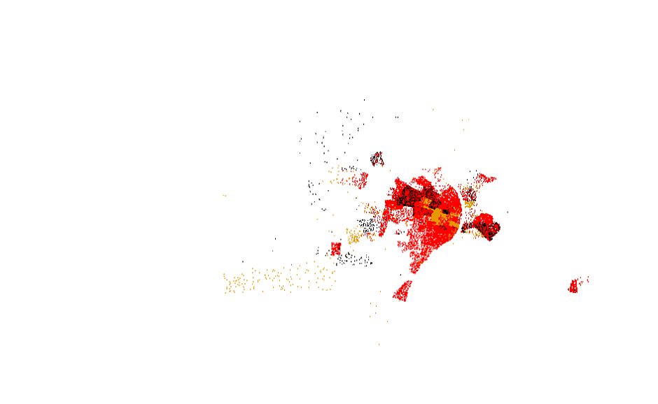
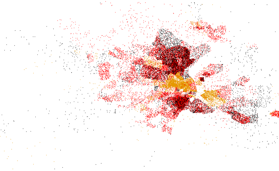
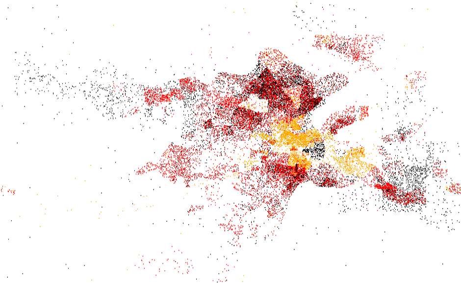


Between 1940 and 1950, whites settled throughout the suburban St. Louis counties and in a few tracts surrounding Forest Park and in the City’s southern reaches. Many of these were new arrivals to the St. Louis area, but many (evidenced by the collapsing white population in many central city tracts) were moving from the City to its suburbs. Blacks, their options constrained by racial deed covenants and other restrictions, settled almost exclusively in a few northside tracts, the old industrial suburbs on the Illinois side, and scattered outposts like Kinloch in north St. Louis County.
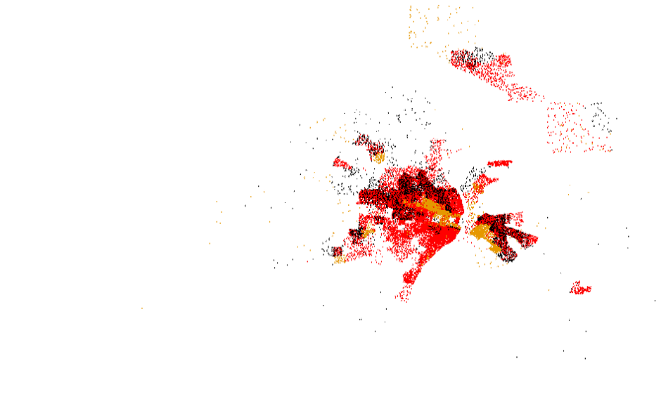
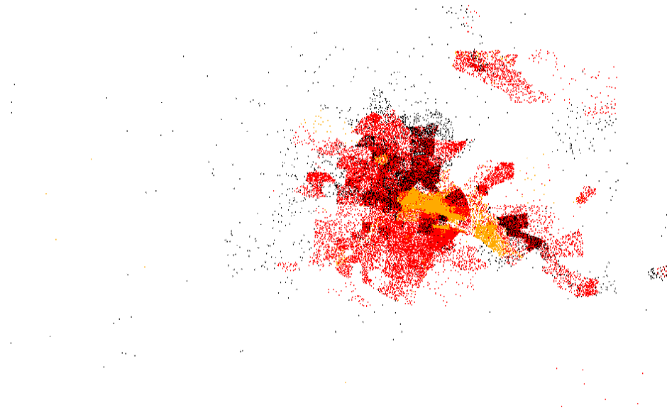
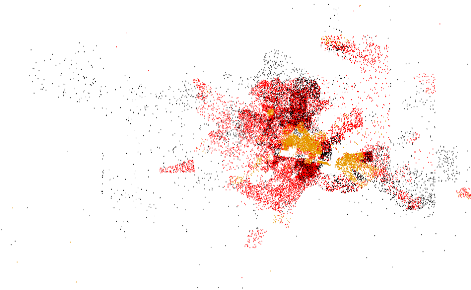
This series of maps shows demographic change between two census years (starting with 1940-1950). In each map, population change is represented by colored dots representing 10 persons.
| increase, white | |
| increase, black | |
| decrease, white | |
| decrease, black |


The history of greater St. Louis, is bound up in a tangle of local, state, and federal policies that explicitly and decisively sorted the City’s growing population by race. These policies yielded both an intense concentration of African Americans in certain wards or neighborhoods of St. Louis itself and a virtually unbreachable wall between the City and its suburbs. The isolation of African Americans on St. Louis’ near northside was accomplished and enforced in a variety of ways; some private and public strategies of exclusion overlapped and reinforced one another, others were cobbled together as legal challenges prohibited some of the more direct tools of segregation. At the center of this story was the local realty industry, which lobbied for explicitly racial zoning in the World War I era; pursued and enforced race-restrictive deed covenants into the middle years of the century; pioneered the practice of residential security rating which governed both private mortgages and public mortgage guarantees; and—as a central precept of industry practice—actively discouraged desegregation of the private housing market.
These maps summarize the principle elements of racial “redlining” as it developed in St. Louis. Click the layers you wish to display from the menu below. For a fuller explanation of each, hover over the layer name below.

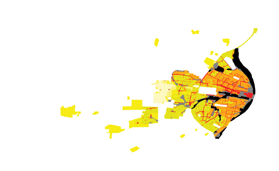
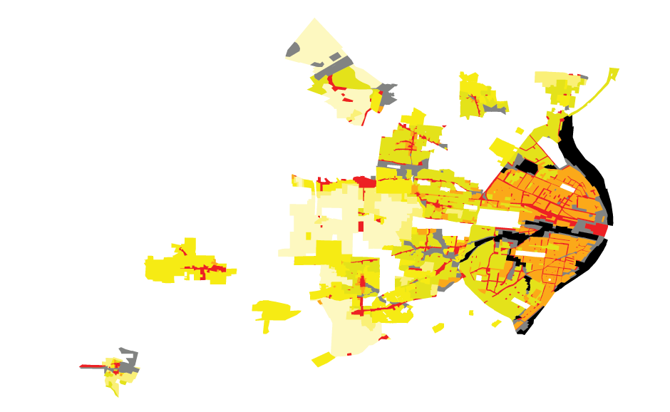

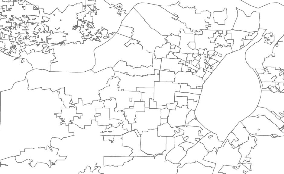
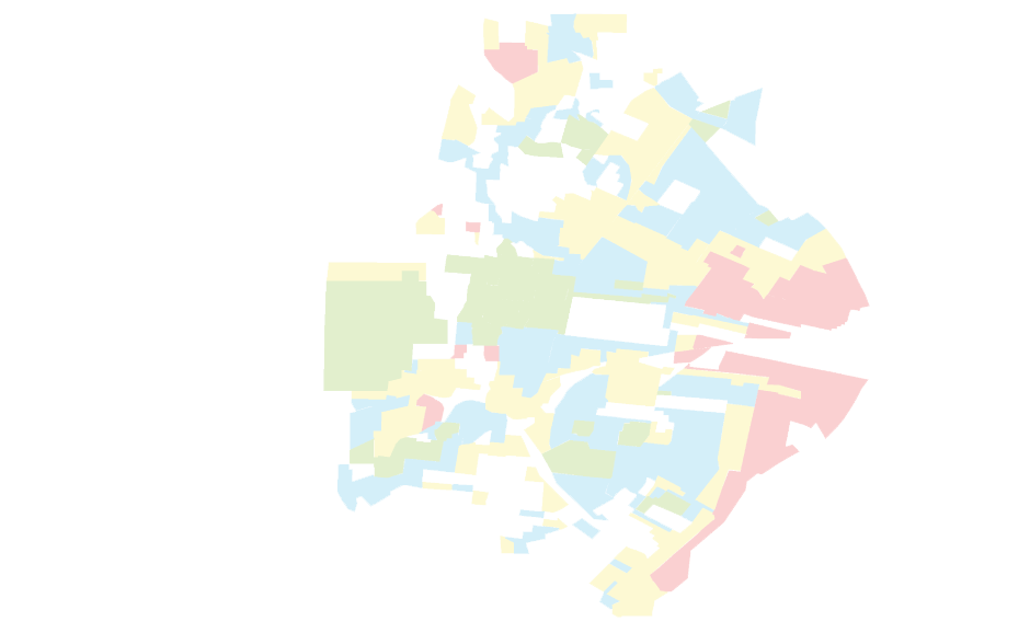
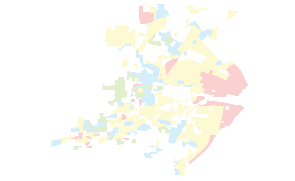
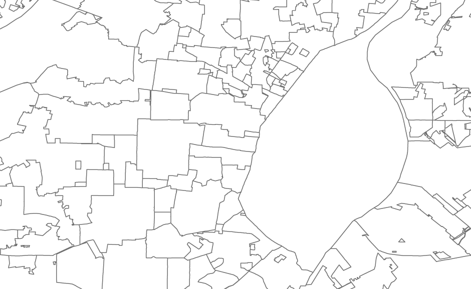
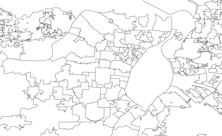
Property zoning emerged as a municipal responsibility, meaning that large metro areas like St. Louis (which, by 2000, included over two hundred incorporated municipalities) were governed by a crazy patchwork of laws which planned or proscribed land use. State enabling acts and local zoning laws embraced two basic principles: separation of use and control over density. A typical zoning ordinance broke the municipality into discrete use districts: residential, commercial, industrial. These districts, in turn, were divided again into neighborhood, highway, and central business commercial districts; heavy and light industry districts; and an elaborate scale of residential zones which not only established separate single-family, duplex, and multifamily (apartment) districts but further divided each of these by lot and building size.
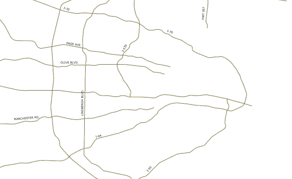
These maps show the development of zoning in St. Louis and its Missouri suburbs.
1935
As of 1935, zoning law covered only the city of St. Louis and a few inner suburbs (including University City, Kirkwood, and Webster Groves). The City zones, first drafted in 1918 but not upheld by the courts until 1927, attempted to shore up property values by protecting private streets and neighborhoods protected by deed covenants. Since the City was already substantially built, zoning was less a blueprint for the future than it was a means of protecting existing investments and managing neighborhood transition. The architects of the zone districts readily admitted that they were essentially descriptive and were determined largely by existing patterns of development. Early suburban zoning was an extension of this pattern.
Choose a year on the bar below, and switch to the “info” tab above, for a sketch of zoning patterns and policies from 1935 to 2003.
| unrestricted (any use) | |
| industrial | |
| commercial | |
| multi-family | |
| single family, small lot (under 10,000 sf) | |
| single family, medium lot (10-30,000 sf) | |
| single family, large lot (over 30,000 sf) |


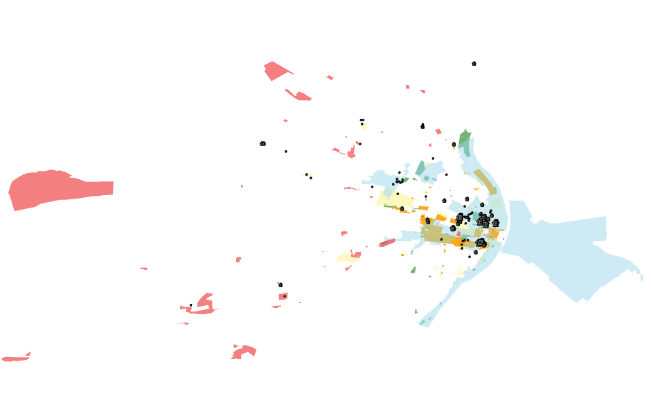
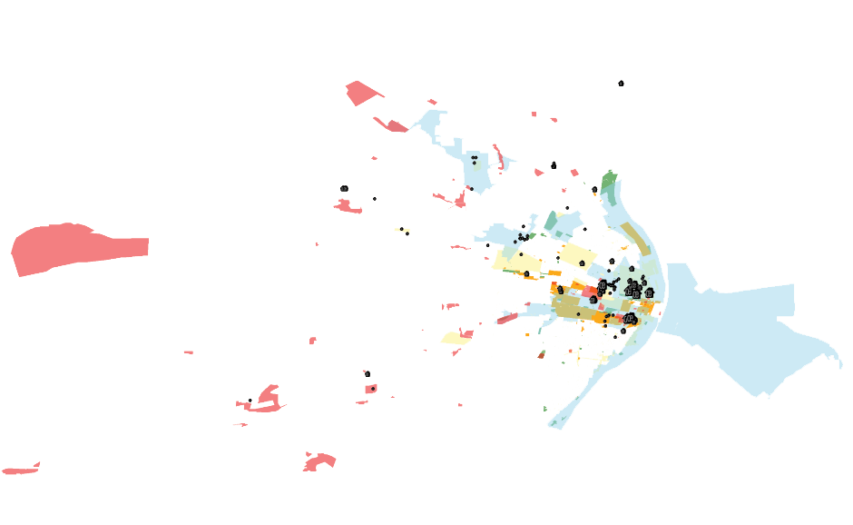
The prescription for central city decline, in St. Louis and elsewhere, was urban renewal. Urban renewal has always rested on a complex tangle of laws and programs and procedures. Typically, a project might rely on an infusion of federal money to clear and assemble land, a state law enabling local authorities to delineate and blight a redevelopment area, and the creation of a private redevelopment corporation that effectively borrowed the power of eminent domain. But the initiative usually ran in the opposite direction: a private developer identified a prospective property, the local government responded by blighting the area, and state and federal money followed. In turn, state and local efforts yielded a welter of discrete yet overlapping programs, any number of which might come into play for even a single redevelopment proposal. Over the course of the postwar era, redevelopment interests in St. Louis could avail themselves of the urban redevelopment law (1945), the land clearance law (1951), an Industrial Development Authority with the power to issue tax-exempt revenue bonds (1967), the City’s Land Reutilization Act (1969), a Planned Industrial Expansion Authority (1969), the State’s tax increment financing program (1980), state (1983) and federal (1994) enterprise zones, and a wide array of local, state, and federal programs targeting specific business interests. This map offers a chronological inventory of the major urban renewal programs at play in greater St. Louis since 1950.
Move the slider at the bottom of the screen to view the spread of “blighted” areas under various programs.
For a fuller explanation of each program, hover over the legend name at right.
| Urban Redevelopment Corporation Law (1943) | |
| Land Clearance for Redevelopment Authority (1951) | |
| Public Housing (scaled by project size) | |
| Planned Industrial Expansion (1967) | |
| Model Cities (1967-72) | |
| Tax Increment Financing (1982) | |
| Enterprise Zone (Missouri, 1982) |